


News | Job Vacancy | Tv/Interviews | Scholarships | Educations | Entertainment | Biography | Got Talent's | Phones | Super Stories | Sports News | Comedies | Business | Relationship | Tech | Movies Series | Search
Posted by: Raji-Baba« on: June 06, 2015, 09:30:47 PM » BackCountry Navigator TOPO GPS v5.7.2
Requirements: Android 1.6+ Overview: Use your phone or tablet as an offroad topo mapping GPS with the bestselling outdoor navigation app for Android! Explore beyond cell coverage for hiking, hunting and more. 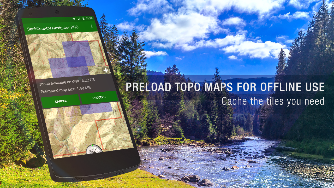 Use your phone or tablet as an offroad topo mapping GPS with the bestselling outdoor navigation app for Android! Explore beyond cell coverage for hiking, hunting and more. Download topo maps for the US and some other countries in advance, so you won’t need cell coverage when navigating. This uses many publicly available map sources as free downloads. It also has some additional content available as an in app purchase: Boundary maps for 12 western states from the Bureau of Land Management (BLM) for $7.99. Great for hunters, hikers, and prospectors. Content from US TrailMaps for $15.99, Including: Snowmobile Trail Maps for Snowmobiling enthusiasts, ATV Trail Maps Whitewater Trail Maps, Equestrian Trail maps. See these in the menu under More-> “Purchasing AddOns”. You are welcome to try the DEMO version to make sure you like the maps in your country. NOTE: If you’ve already purchased this or any paid app, you can install it at any time from ‘My Apps’ in the Android Market. Use offline topo maps and GPS on hiking trails without cell service! The GPS in your Android phone can get its position from GPS satellites, and you don’t have to rely on your data plan to get maps. Have more fun and safe GPS adventures in the backcountry. Preload offline topo maps, aerial photos, and road maps on your storage card, so they are ready when you need them for your GPS navigation. Many free map source are built into the app. Add custom GPS waypoints in longitude and latitude, UTM or MGRS grid reference. Import GPS waypoints from GPX files. Choose mapsource-like icons for GPS waypoints. (This app uses the WGS84 datum, NAD27 is available in settings). Use GPS for hunting a waypoint or geocache, for recording tracks and GPS waypoints on your trip, all the while tracking your GPS quest on topographic maps. What’s New Canada Map Server Changes Android Wear Extensions (beta). See Helpdesk for topic. Fix for Accuterra retrieval issue in 5.7.0 Kml import improvements. NEW: use Styles with topo maps from openandromaps.com/en Other fixes and adjustments. Addons include Accuterra map source, Digital Globe Subscription GMUs of various states. SnowMobile trail maps, ATV, Equestrian, Birding, and Whitewater trail maps, and BLM Land Boundary Maps of 12 western states. This app has No advertisements More Info: Code: Select allhttps://play.google.com/store/apps/details?id=com.crittermap.backcountrynavigator .license Download Instructions: https://userscloud.com/nowlr6jxl9nu Mirror: http://ul.to/kptmsb0v https://www.tusfiles.net/zqrupyj5k2al
|
 Similar topics (5)

|
CM Transfer Share files v1.4.0.154 apk
Started by Raji-Baba |
Replies: 0 Views: 2743 |

|
lucky Launcher // CM12 theme v1.1.0 apk
Started by Raji-Baba |
Replies: 0 Views: 2795 |
|
|
Minimal Line Luncher Style CM12 theme v1.0 apk
Started by Raji-Baba |
Replies: 0 Views: 2390 |
|
|
HOT: Gun Master 2 v1.0.12 apk
Started by Raji-Baba |
Replies: 0 Views: 2688 |
|
|
Hot: Turbo Wheels v1.0.3 apk
Started by Raji-Baba |
Replies: 0 Views: 1923 |
|
|
|
 Recent Topics
Chance The Rapper & DJ Premier Release New Song ‘Together’ - Watch The Video by Mr. Babatunde
[May 15, 2024, 04:35:20 PM]
I was surprised Rihanna knew me – Ayra Starr by Miss Ifeoluwa
[May 14, 2024, 10:38:51 AM]
Osun Governor Adeleke Installed As Asiwaju Of Edeland by Miss Ifeoluwa
[May 13, 2024, 05:30:23 PM]
Increase in electricity tariffs daylight robbery – Kogi NLC by Miss Ifeoluwa
[May 13, 2024, 10:59:14 AM]
Read-a-Thon: Osun Online Publishers Association Applauds Ajao Samson's Effort... by Miss Ifeoluwa
[May 12, 2024, 07:55:24 AM]
|
|
|